STOKE ST MARY, SOMERSET, ENGLAND


STOKE ST MARY HISTORICAL RECORDS
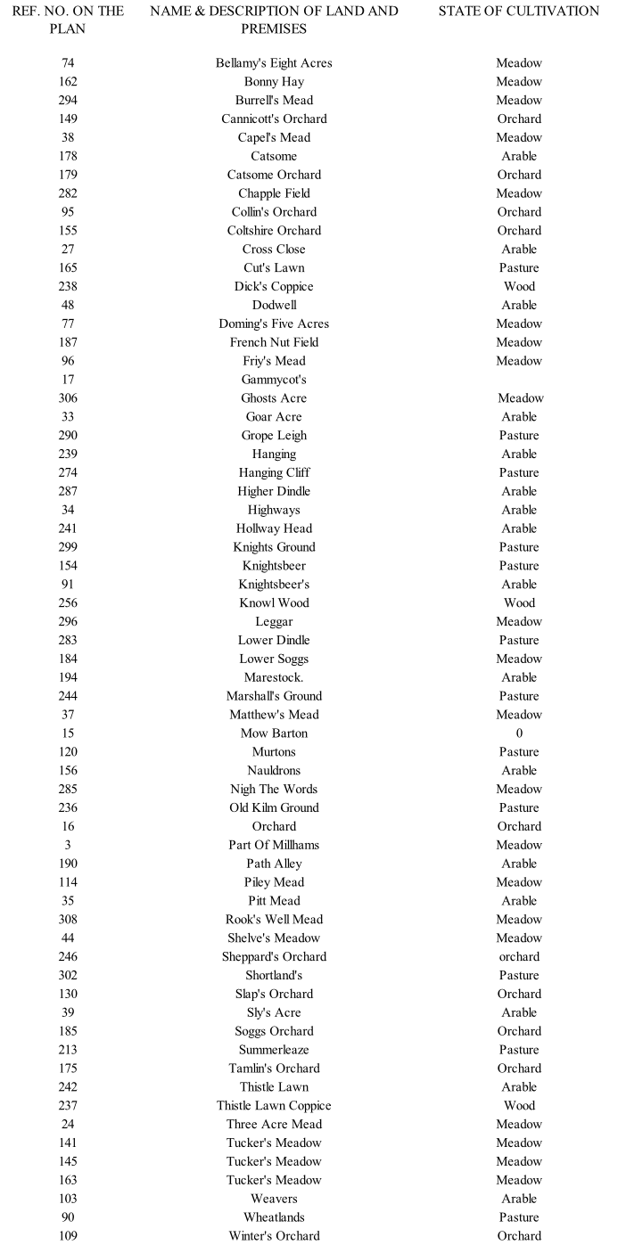
the 1837 Tithe Map
In 1837 the Tithe Commissioners came to Stoke St Mary and drew up a plan of the Parish listing every field and building. Many of the field names were just descriptions of either size [e.g. four acre field] or its use
[e.g. orchard, quarry or withy bed], The more interesting names are set out below with their reference number on the map [to be found in the Village Hall or at Somerset Record Office].
